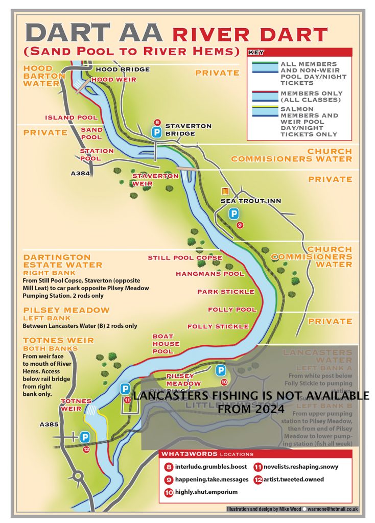
PLEASE NOTE THE FISHING AT DARTINGTON AND LANCASTERS ON MAP 3 IS NOT AVAILABLE FROM 2024 ONWARDS.
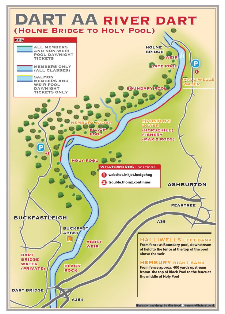
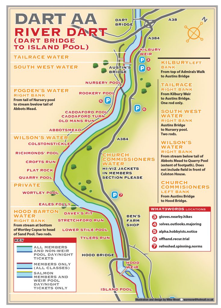
These maps show the extent of the bulk of our fishing. For our Dart Gorge fishery please see the ‘Legacy’ Maps page.
To aid orientation: The following link should download a folder of Google Earth placemarks referring to various relevant sites and access points to our fishing on the Dart. Please note that these placemarks are provisional and no responsibility can be taken for their accuracy. Any suggestions for corrections gratefully received. You need Google Earth installed to view them. Once downloaded, just double click on the .kmz file and it should load itself into the temporary places folder in GE. The file contains a sub folder called ‘Dart Angling Association’. Drag and drop that into the ‘My Places’ folder. If you are replacing an older version of the file, delete the older one first to avoid duplicating placemarks.