(Newer versions of maps here)
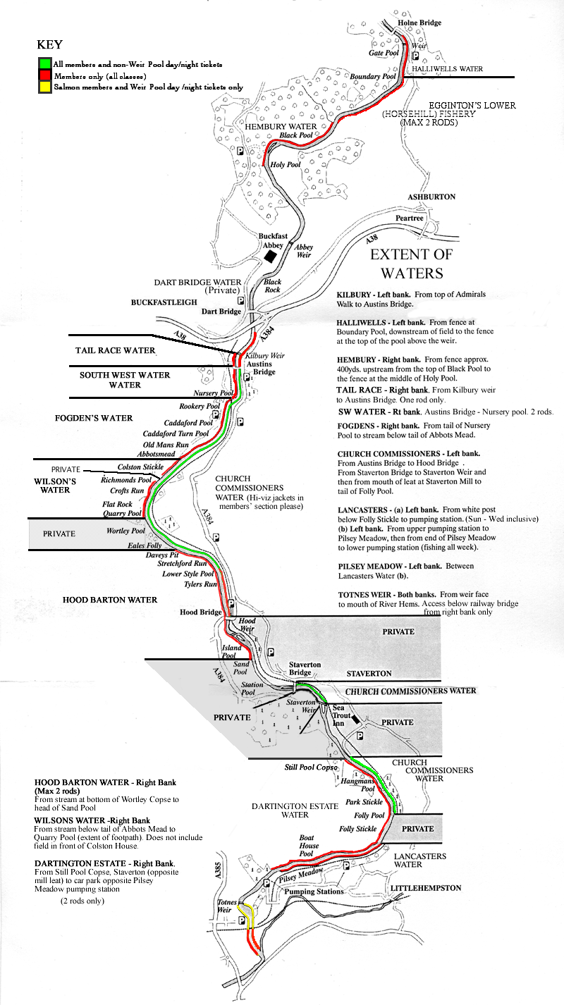
The maps below (not to scale) show the extent of Association waters.
The map immediately below shows access to the Dart Gorge fishery, with a maximum of two rods. Fly only. Click through to see a detailed map of the fishery.
Scroll down to see the lower map, which shows the bulk of our fishing a little further downstream. It is colour coded to show those beats which are available to members and those which are also available to visiting anglers on purchase of a day ticket. (Or night ticket in the case of Sea Trout fishing)
The following link should download a folder of Google Earth placemarks referring to various relevant sites and access points to our fishing on the Dart. They should be used for orientation in conjunction with the maps. Please note that these placemarks are provisional and no responsibility can be taken for their accuracy. Any suggestions for corrections gratefully received. You need Google Earth installed to view them. Once downloaded, just double click on the .kmz file and it should load itself into the temorary places folder in GE. The file contains a sub folder called ‘Dart Angling Association’. Drag and drop that into the ‘My Places’ folder. If you are replacing an older version of the file, delete the older one first to avoid duplicating placemarks.
If you do not have Google Earth, find out more and download it here
DART GORGE FISHERY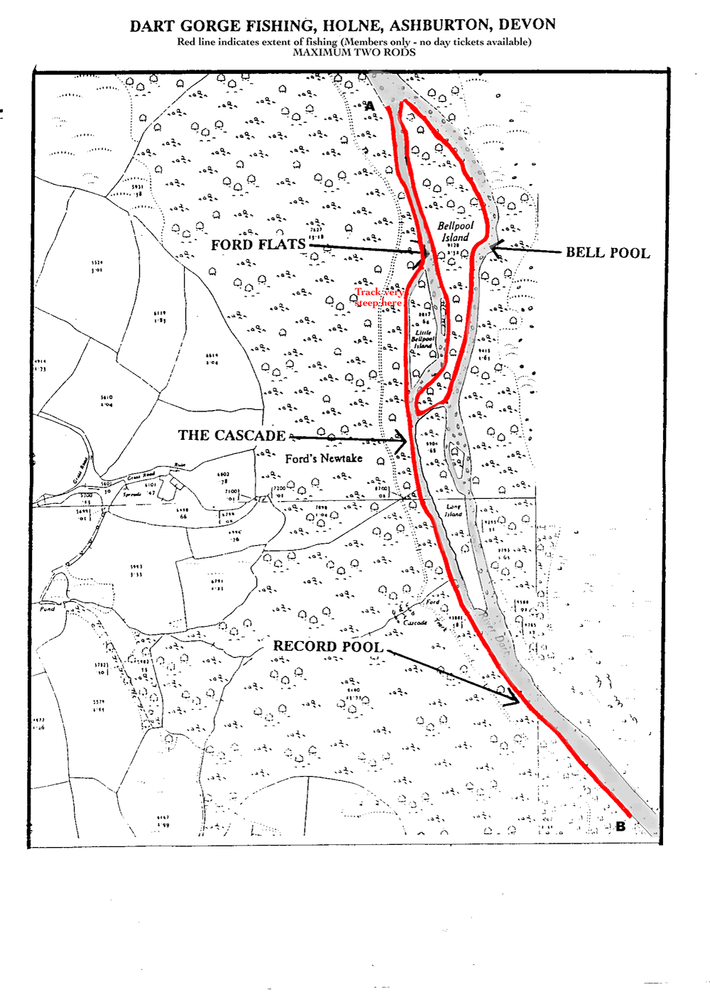
OUR OTHER WATERS